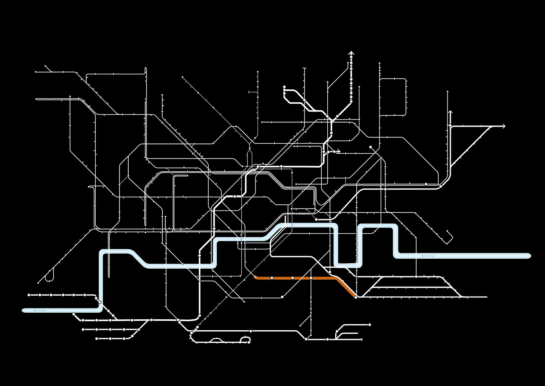
Bakerloo Line
As part of the Bakerloo Line Extension study, our team have been working with TfL developing a series of urban typologies, encompassing a range of conditions from the suburban edges to the metropolitan centre.Client
Transport for London
The extension will improve journey times and offer better connections within southeast London, and into central London. Trains and signalling on the Bakerloo line will be upgraded at the same time, which will increase capacity on the existing line. Across the Bakerloo line, the extension and upgrade could support the delivery of over 100,000 new homes and over 130,000 new jobs across London.
The plan is to:
– Extend the Bakerloo line from Elephant and Castle to Lewisham (initially)
– Build a new Bakerloo line ticket hall at Elephant and Castle
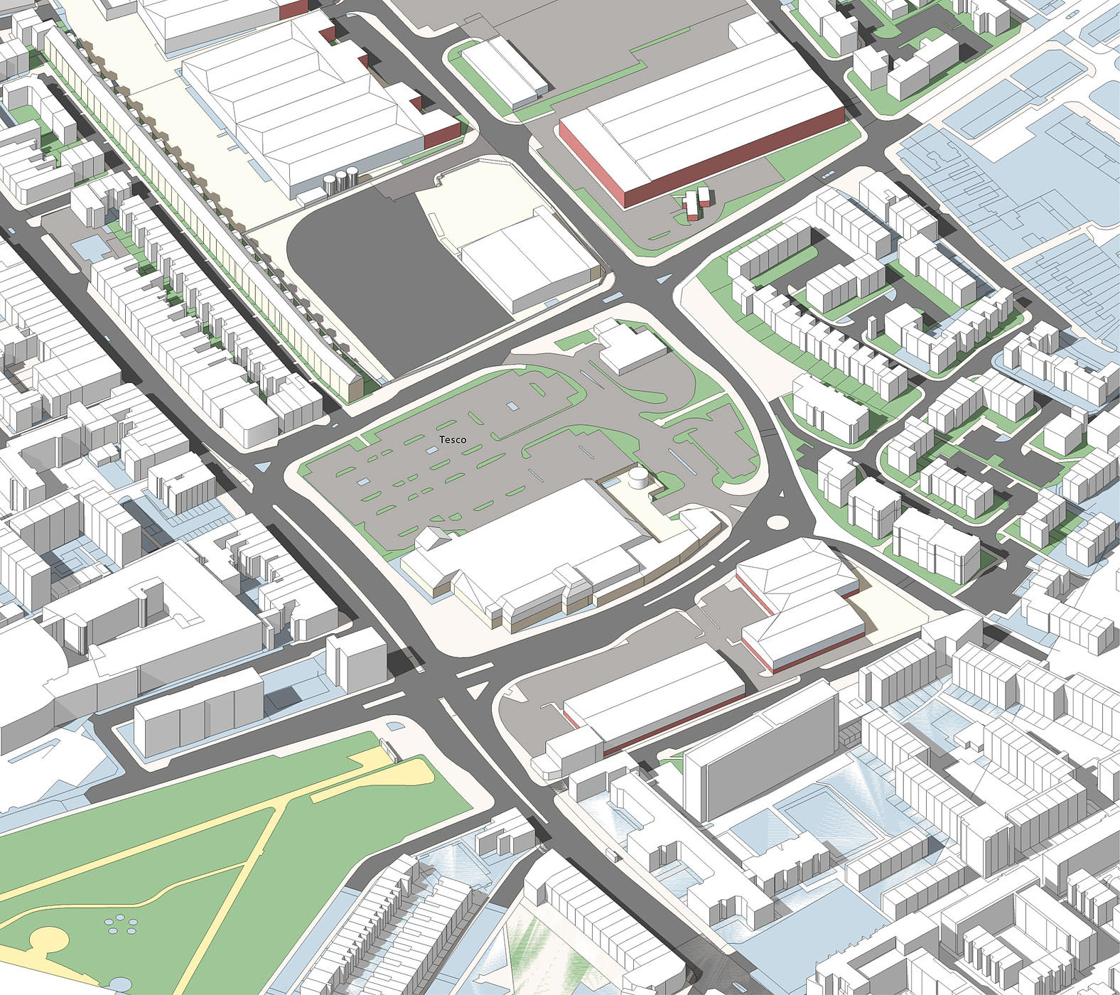
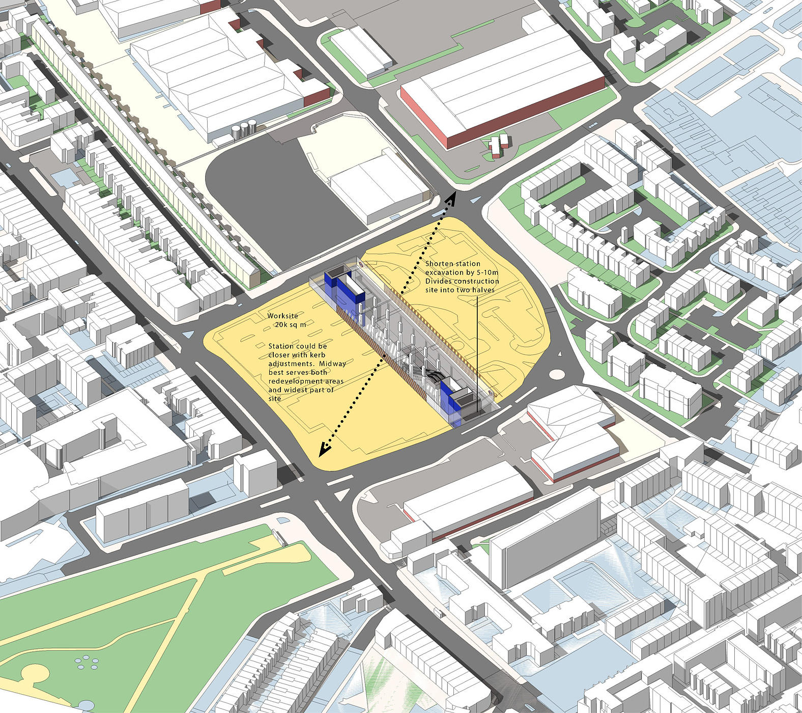
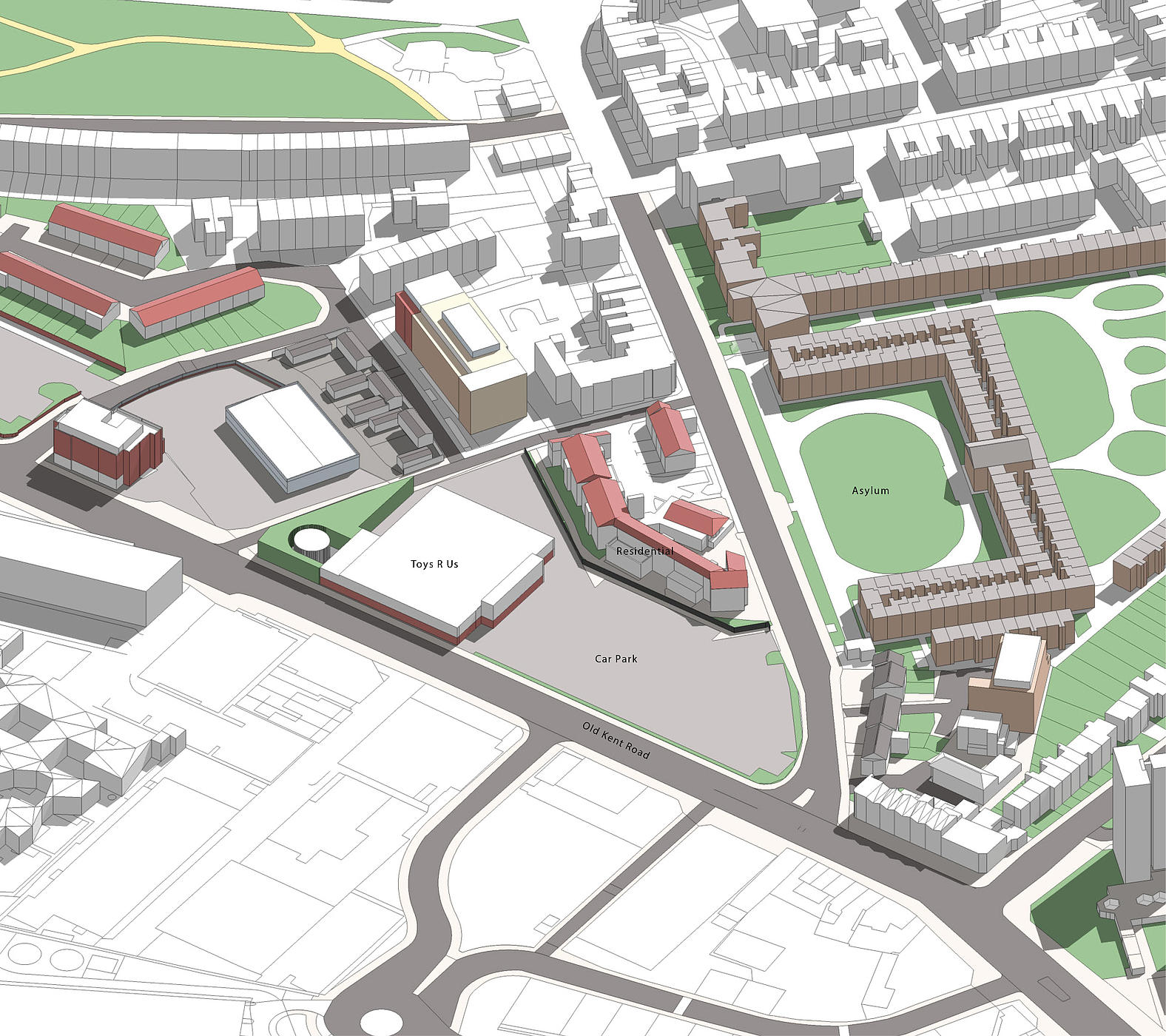
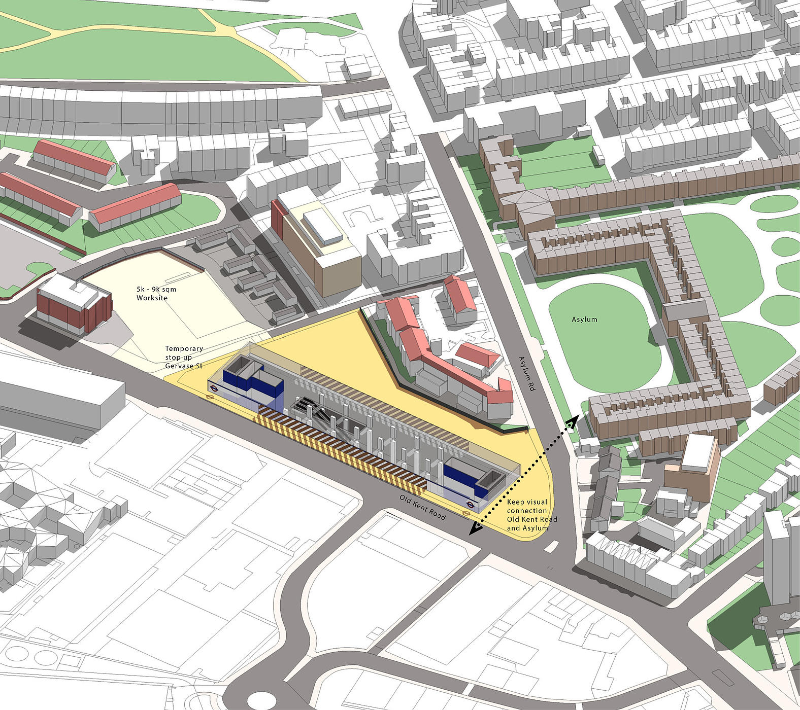
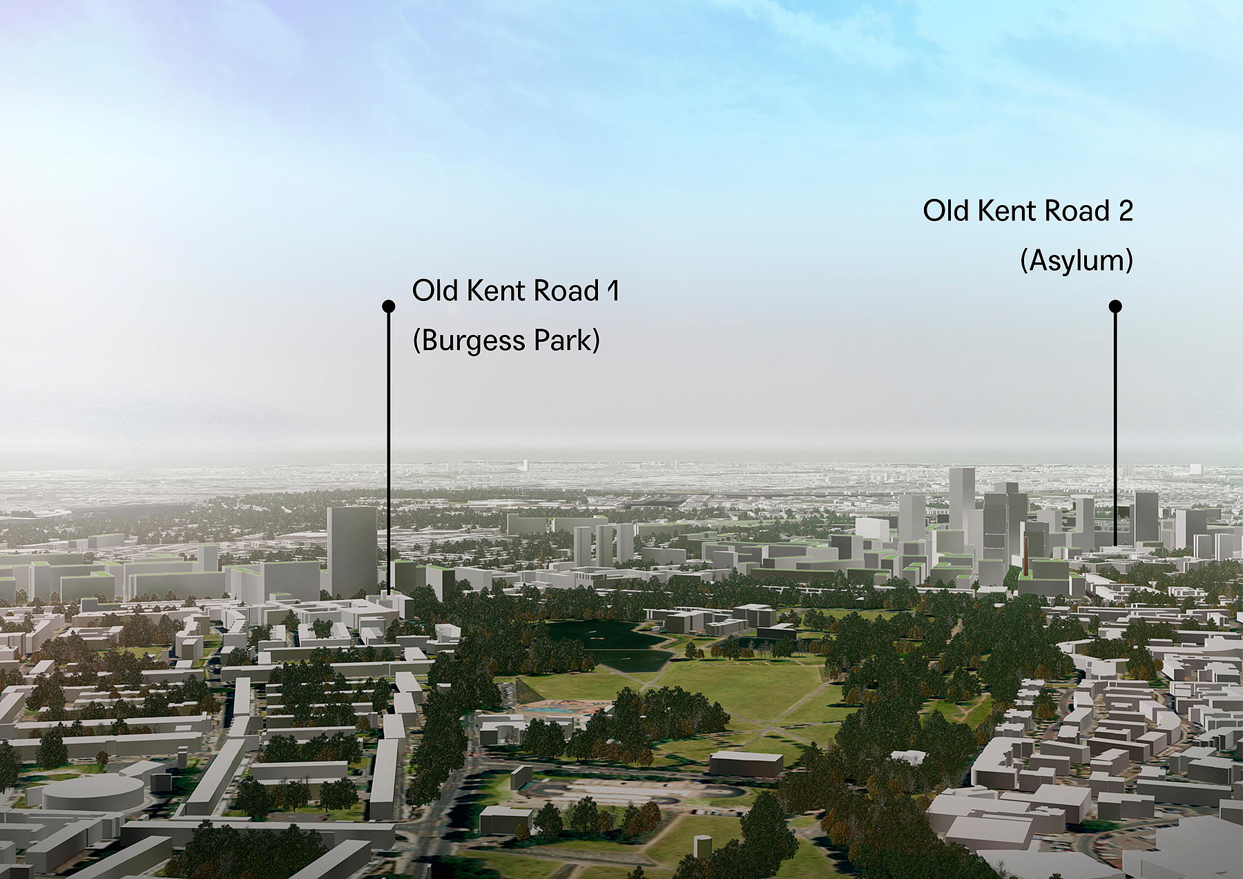
– Take the route from Elephant and Castle along the Old Kent Road where two new stations are proposed
– Create a new station at New Cross Gate to provide better connectivity to National Rail, Overground and buses
– Improve the interchange station at Lewisham linking National Rail, DLR and buses
– Improve congestion on the roads by increasing capacity on the tube, reducing air pollution and CO2 emissions
– Free up capacity on other lines and buses, making journeys less crowded and more pleasant
Commercial Corridor
The Old Kent Road stretches along 1.7 miles through South East London. It is one of the oldest routes in London, connecting Dover to Roman Londinium and has retained its sense as a permanent radial commercial corridor. The alignment of the Bakerloo Line Extension will run in parallel and offers the opportunity to identify the clusters of associated development potential along its length, in conjunction with station locations. It is anticipated this can enable 25,000 new homes and 5,000 new jobs
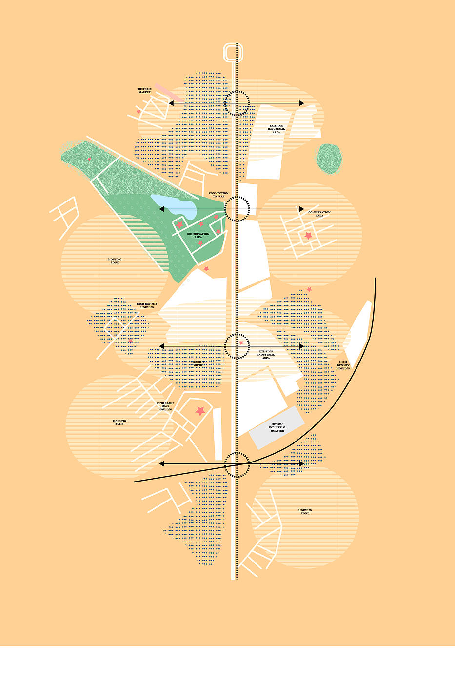
New Parkland
Burgess Park is highly unusual within London, the 56 hectare park has been formed relatively recently from a previously heavily built-up part of London. It emerged from the 1943 Abercrombie Plan and was primarily formed by the closure of the Grand Surrey Canal in the 1970s. It forms an unusual precedent for forming new park landscape within South London, using the former canal route to define a new landscape corridor.