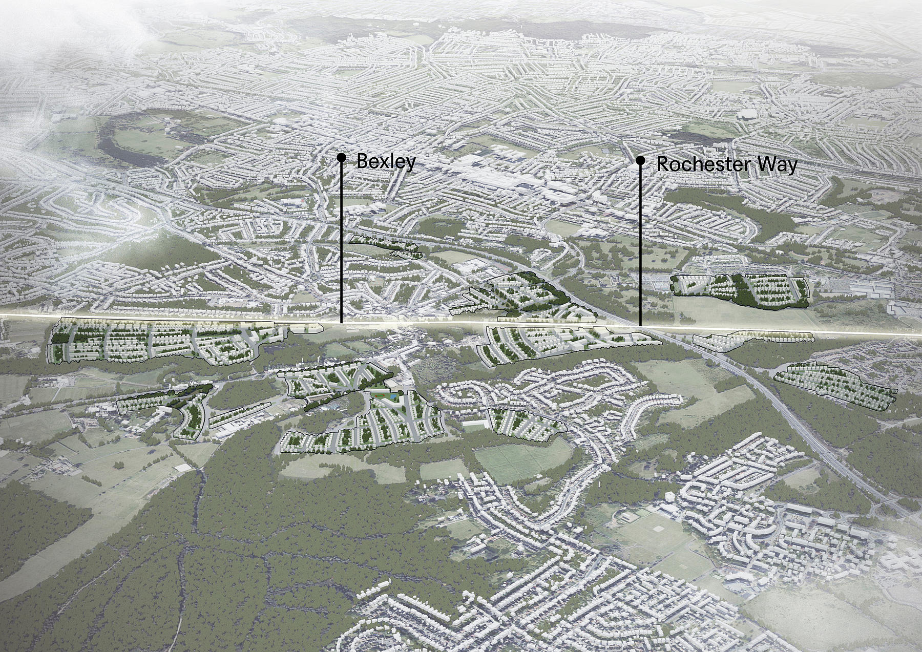
North Kent + C2C
As part of the C2C study, our team have been working with TfL to explore the potential strategic benefits of improved transport connections, developing a series of urban typologies, encompassing a range of conditions from the suburban edges to the metropolitan centre.Improving the frequency and accessibility of these combined services, offers the potential for new homes and jobs across the Thames Gateway.
c2c operates services on the London, Tilbury and Southend Railway line from London Fenchurch Street to the northern Thames Gateway of southern Essex, including Grays, Leigh-on-Sea and Southend-on-Sea. On the southern Thames Gateway, with the London terminus at Charing Cross station, the North Kent Line runs from a junction of the South East Main Line, to a point south-west of Strood station by the River Medway in Medway where it links to the Chatham Main Line.
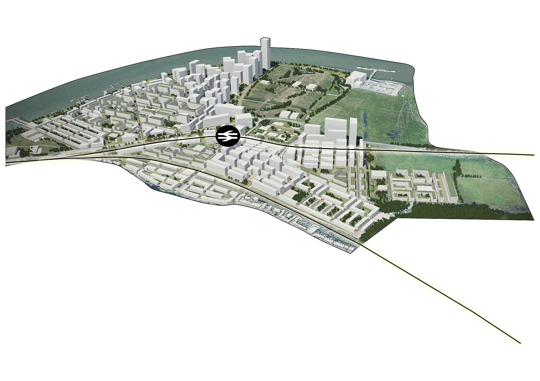
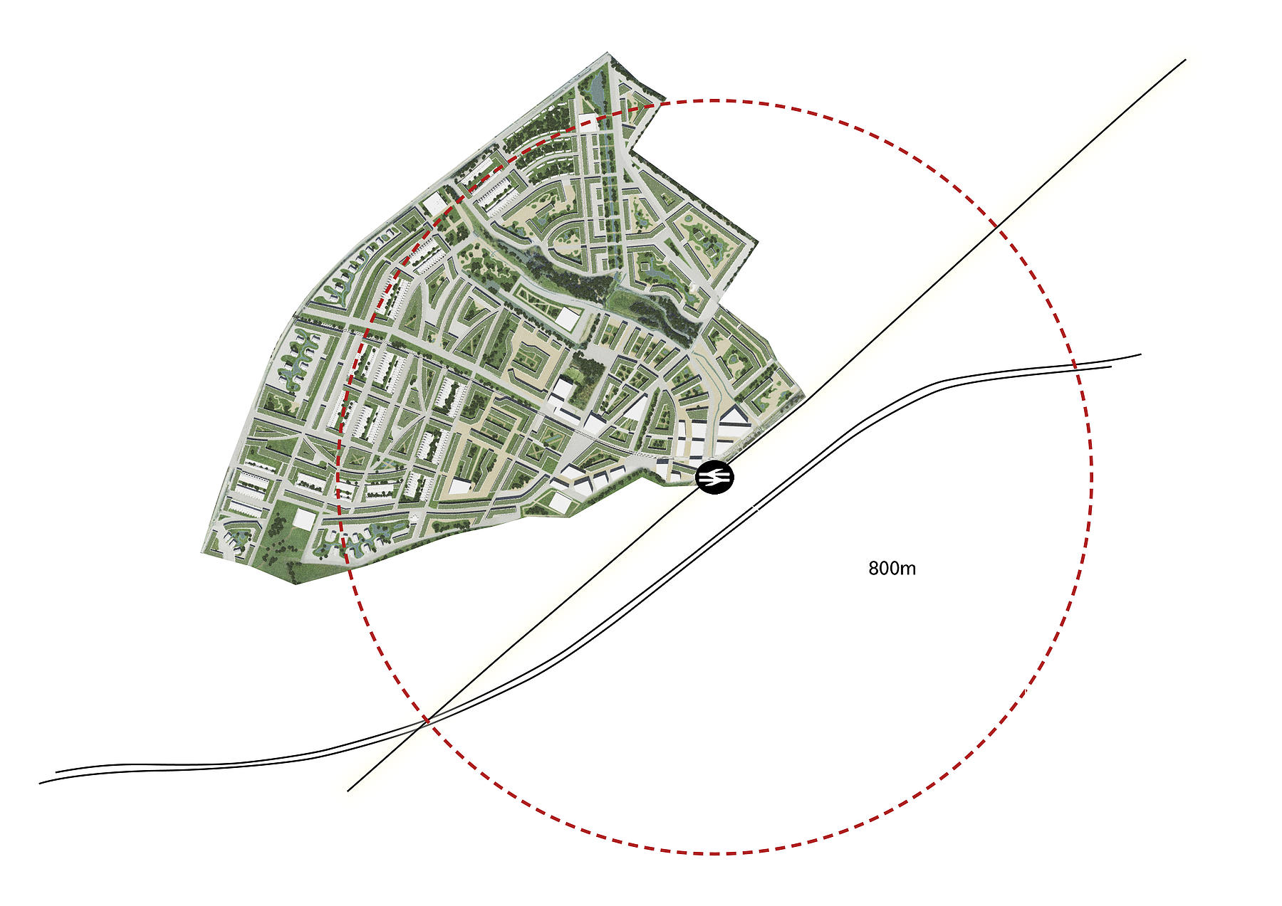
Enhanced River Edge
This typology seeks to enhance and develop an existing river edge centre by the following:
– Providing sufficient density and scale of development to support investment in a new riverside parkland which extends the amenity of existing open space.
– Establishing direct landscape connections from inner parks and suburban streets to green infrastructure corridors to river edges, supporting the provision of community facilities.
– Using the large parkland to define and support a line of high density frontage.
– Providing substantial overhaul and enhancement of a town centre and it’s community facilities, reinforcing the use of green corridors as routes into the wider landscape around London and to other District Centres.

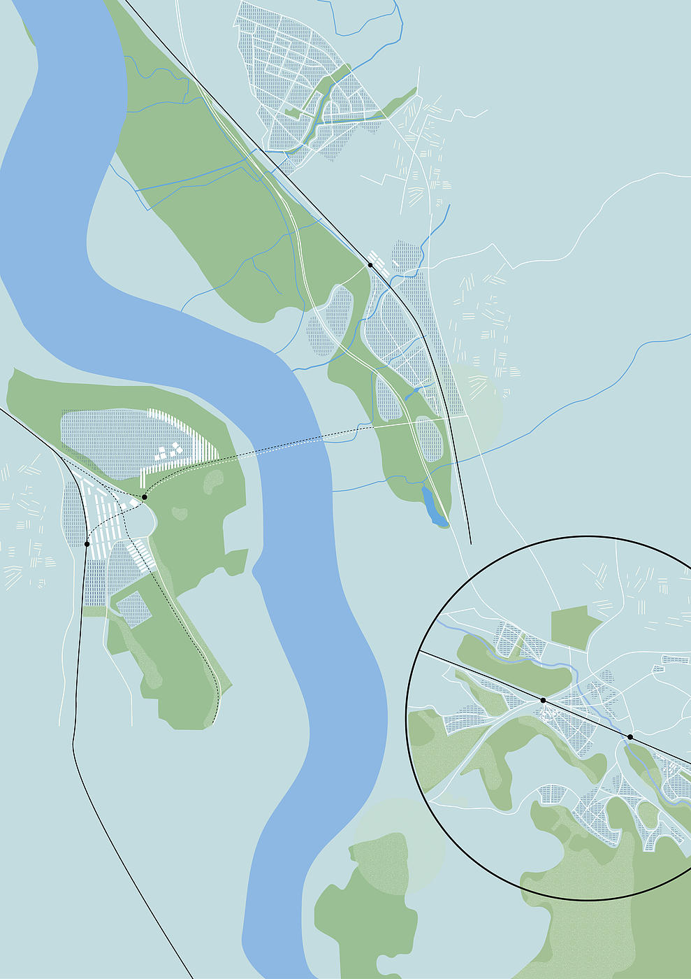
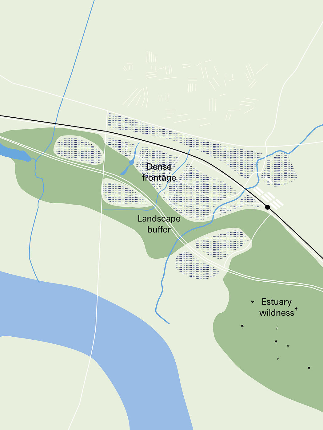
Parkland Edge at Rainham
This typology takes into account the potential of existing natural resources and extends them into new development, creating an even larger green network. It combines playing fields, allotments and natural parkland to provide a rich open landscape with the opportunity for dense frontage. This can offer a remarkable landscape which might transform in character from more formal parkland into estuary wildness. The scale is such that it can absorb and buffer the existing road infrastructure.
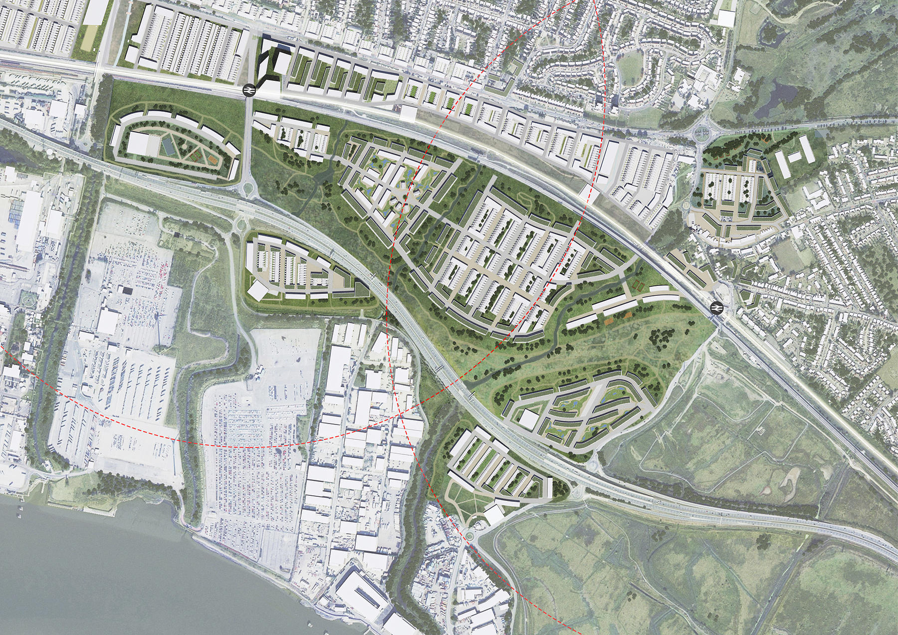
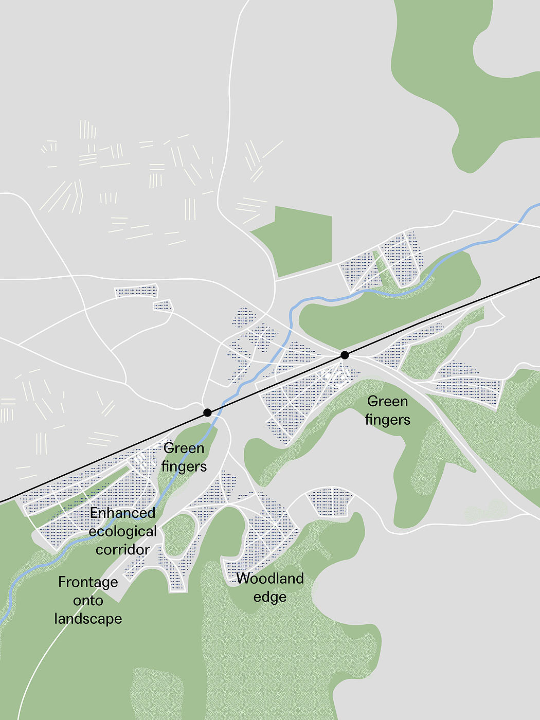
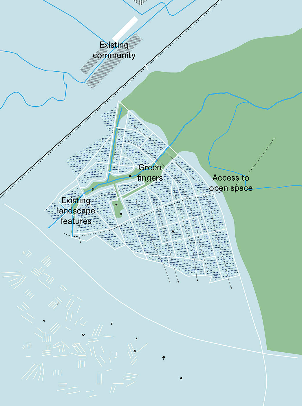
New Town
Any justification for development on the Green Belt requires an approach that offers strong enhancements to the landscape, with significant improvement in public access, ecology and amenity to the current land for the benefit of the new and existing community.
The key constraints and responses are:
– Adjacent sites of nature conservation – Sites that would be further enhanced through improvement of landscape and parkland, promoting pedestrian and cycle links and establishing ecological corridors to enhance habitats.
– Existing landscape features – Layouts need to be planned with consideration of existing hedgerows, field patterns and watercourses; wherever possible these features should be been retained and reinforced by the built forms.
– Existing community – The masterplan must be shaped by the immediate context; the street pattern should stitch into the neighbouring context and provide enhanced links to open space. – – The development must be limited and foster and underpin improved access to landscape.
– Access to open space – The surrounding green space should be brought into the development with green fingers that follow and extend natural features, maximising the amount of homes fronting onto landscape and ensuring every home is within walking distance of high amenity space.
– Community Ownership – Newly enhanced and accessible landscape should be preserved in perpetuity from any further development, ideally under forms of community ownership (Trusts).
Suburban Extension
This typology takes a landscape-driven approach to suburban extension by:
– Consolidating development into compact sites, providing an expanded and improved parkland stretching through the length of the development, rather than a thin buffer.
– Parkland forming continuous green fingers to significantly improve accessibility to landscape .
– Green space incorporating all existing rights of way and enhancing walkable routes to station.
– Allotments, community open space, leisure and playing fields being incorporated into landscape space to enhance active uses and consolidate built development into smaller overall footprint.
– Woodland edges using permeable typologies of villas, houses and mansion blocks with streets connecting directly into woodland walks.
– Smaller areas of woodland and ecology being absorbed into the plan and enhanced with green corridors into wider landscape.