Density Study London Legacy Development Corporation
The London Legacy Development Corporation (LLDC) commissioned MICA to undertake a Density Study designed to provide a tool for the Local Planning Authority, for developers proposing development and for Local Communities as they engage with the development of high density development schemes in the planning process. Shortlisted for Excellence in Plan Making Practice at the Royal Town Planning Institute (RTPI) Awards for Planning Excellence 2021.Client
London Legacy Development Corporation (LLDC)
Location
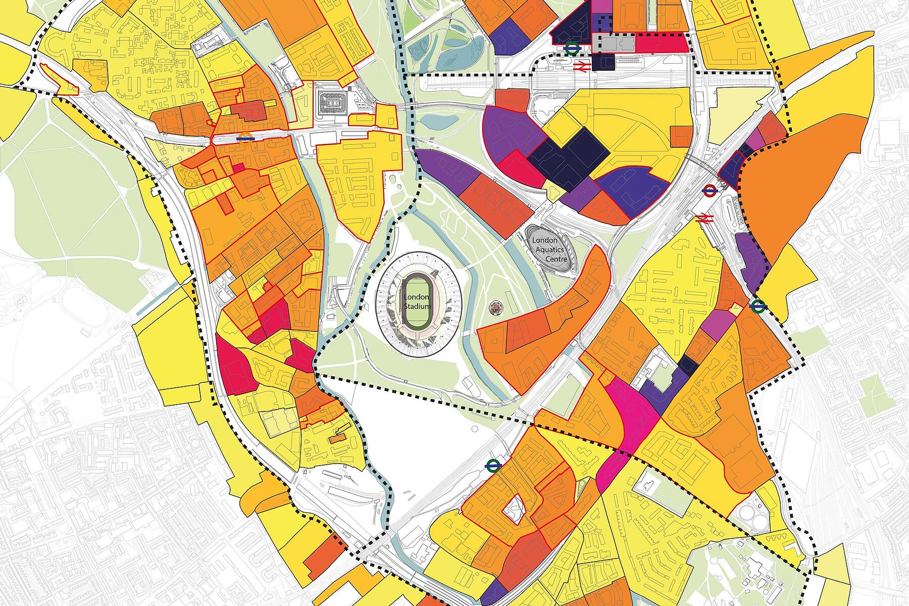
The LLDC planning area
Dates
2019 - 2020
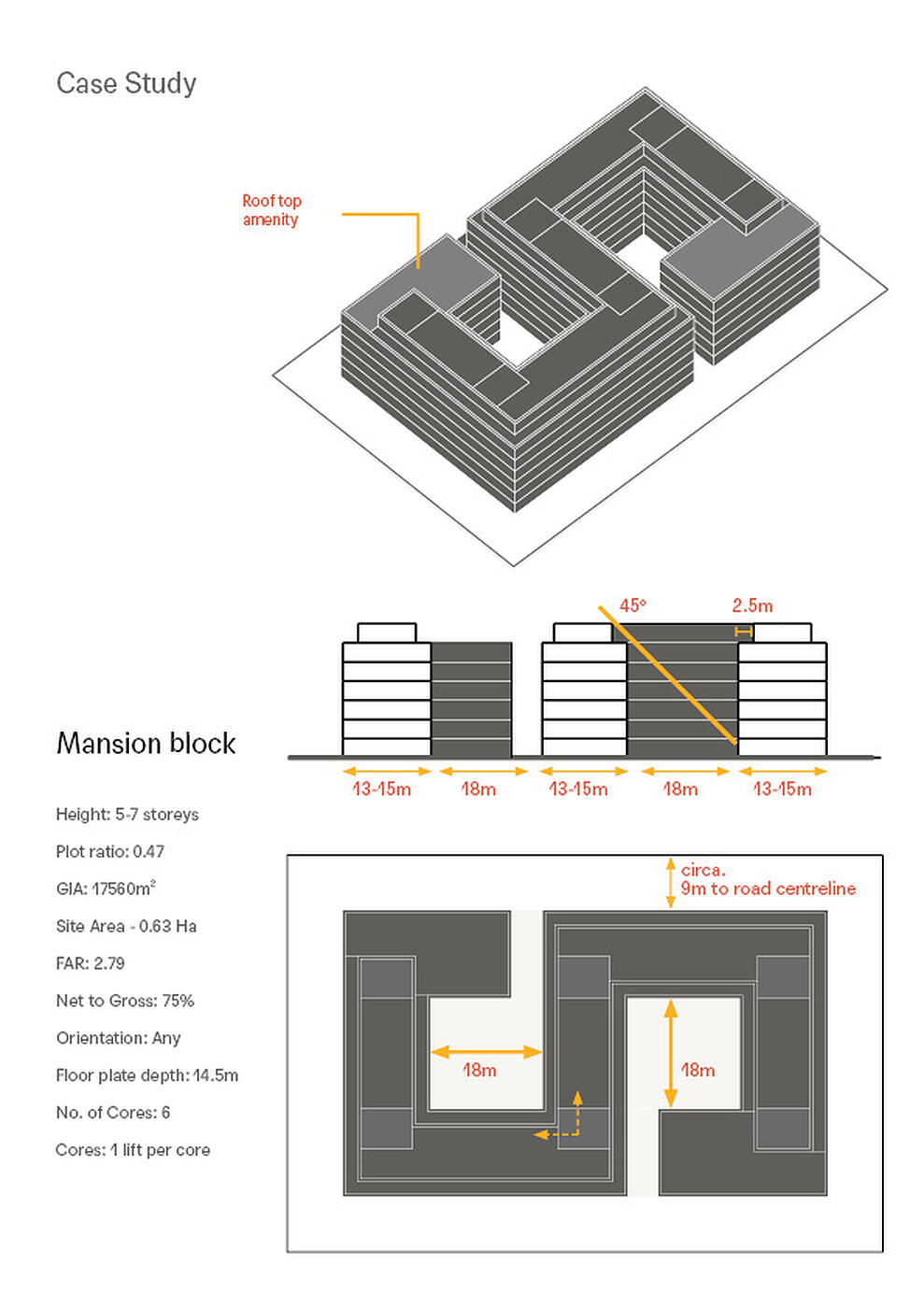
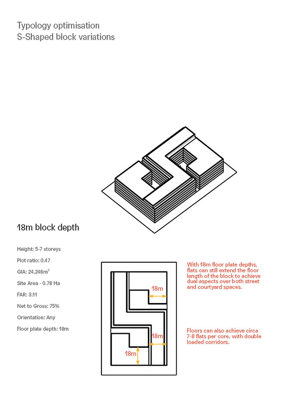
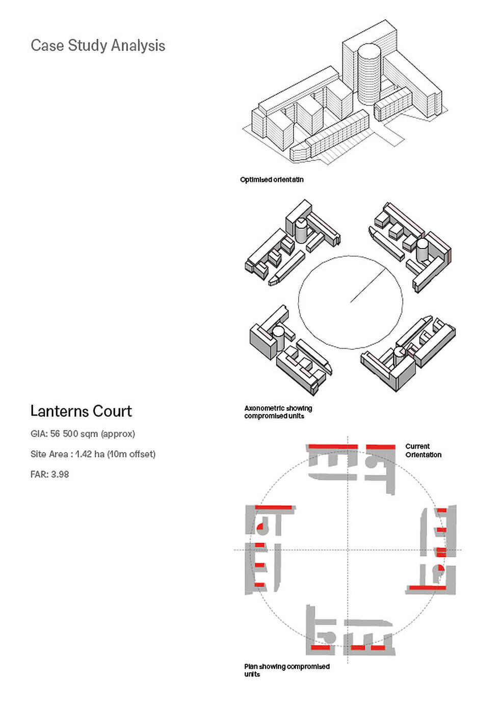
Following our work at Pudding Mill, MICA was engaged anew in 2019 to undertake an LLDC-wide density study. Referencing the new National Model Design Code, our study was designed as a tool for the LLDC as the local planning authority, for developers proposing development, and for local communities to reference as they engage with the development proposals during the planning process. The study provides an overview of development densities in and around the area, and identifies which aspects have potential to make these successful places to live, work and carry out business. The study supports the policies in the LLDC’s revised Local Plan 2020. Through study of various typologies and relevant built examples, the study examines the ways that different densities are achieved: this was essential to cementing the evidence base for responding to planning applications on the Pudding Mill site. The typologies and case study analysis draw conclusions that higher density does not necessarily require high rise development. Critically, we show that medium to high density can be achieved with low to mid rise buildings which are more energy efficient, lower in embodied carbon and flexible to change over time.
The Density Study is an innovative example to local authorities nationwide of publicly accessible tools that convey complex information in a coherent, legible format. This is particularly true for other Opportunity Areas like LLDC land, which have large brownfield areas and significant capacity for development, but where very little baseline information about the density of the area exists. This has become even more relevant with the publication of the government's “Planning for the Future” white paper which requires plans to be visual, standardised and based on the latest digital technology.
Many of the challenges addressed within the Study are not unique to the area: the structure of the detailed analysis of the case studies can also be used as a template for other projects in London and further afield, specific to each authority and density range.

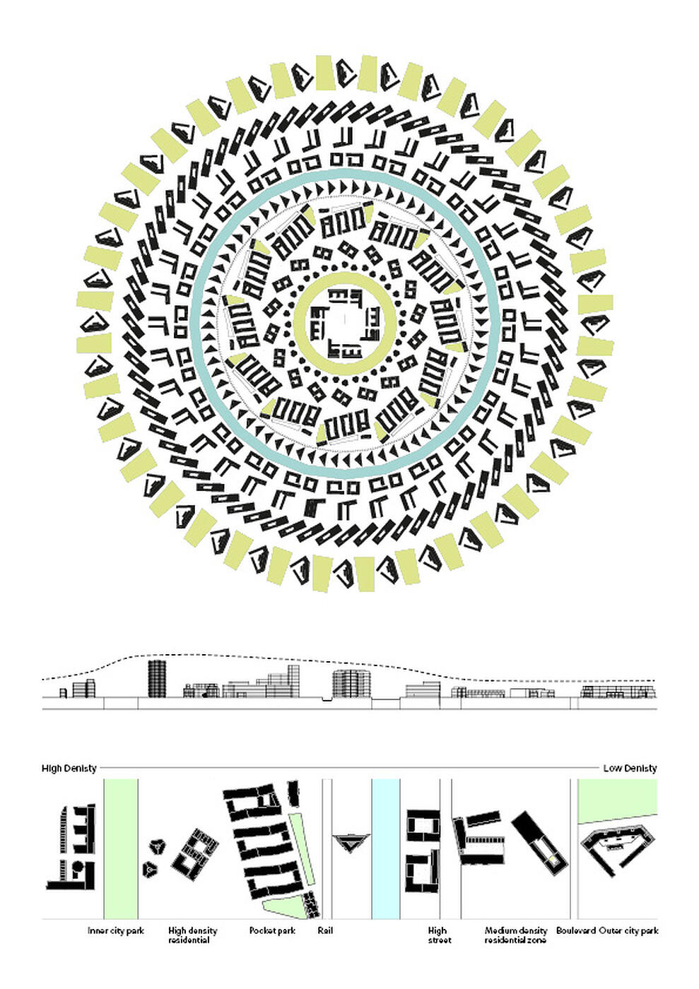
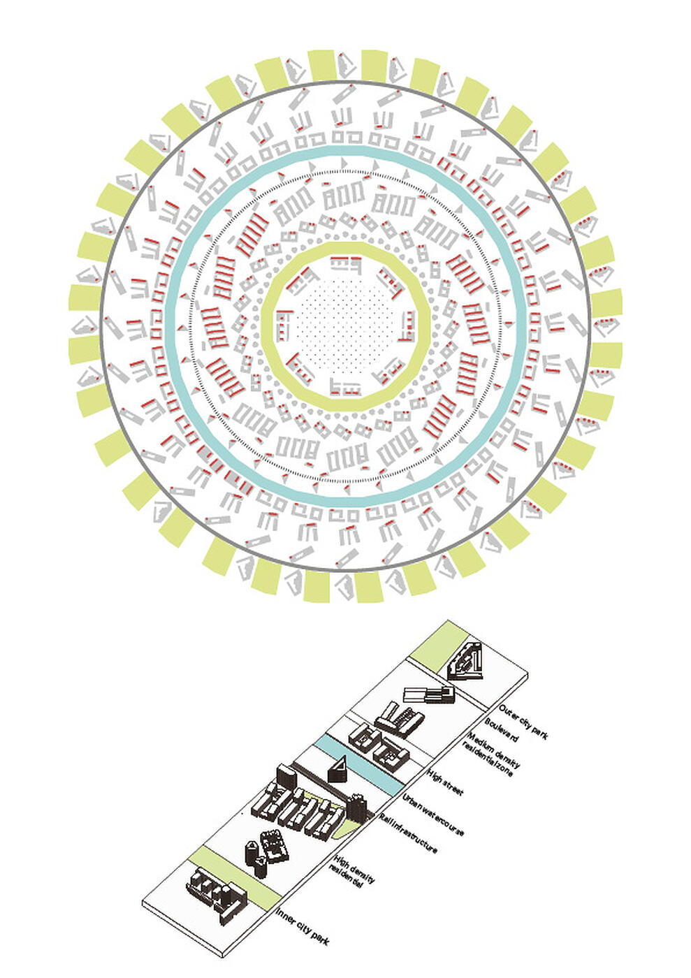
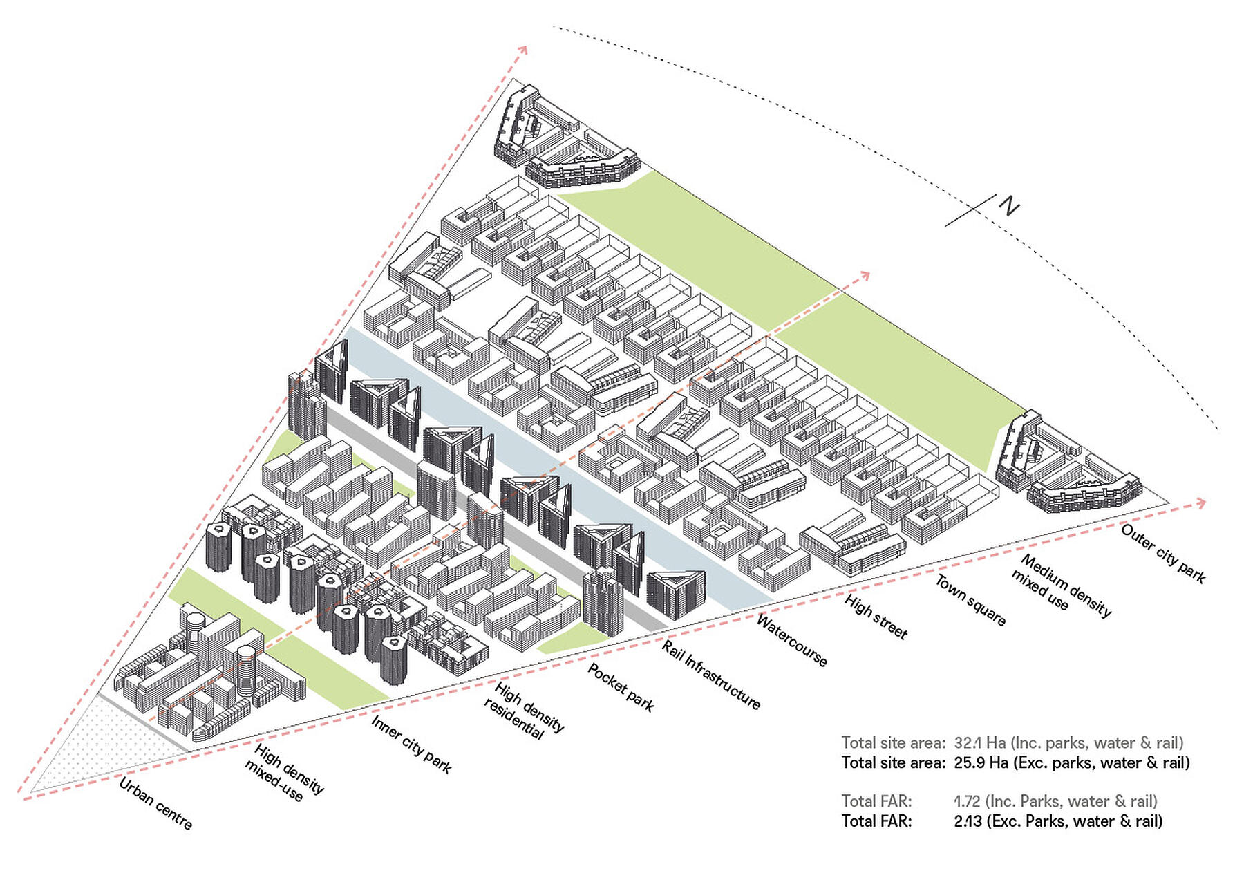
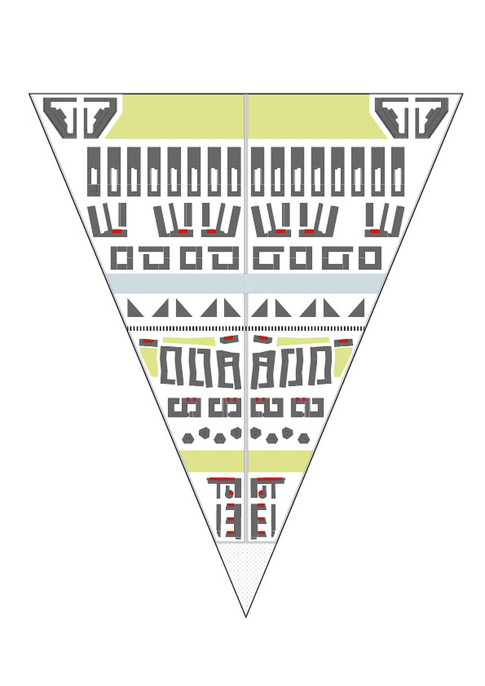
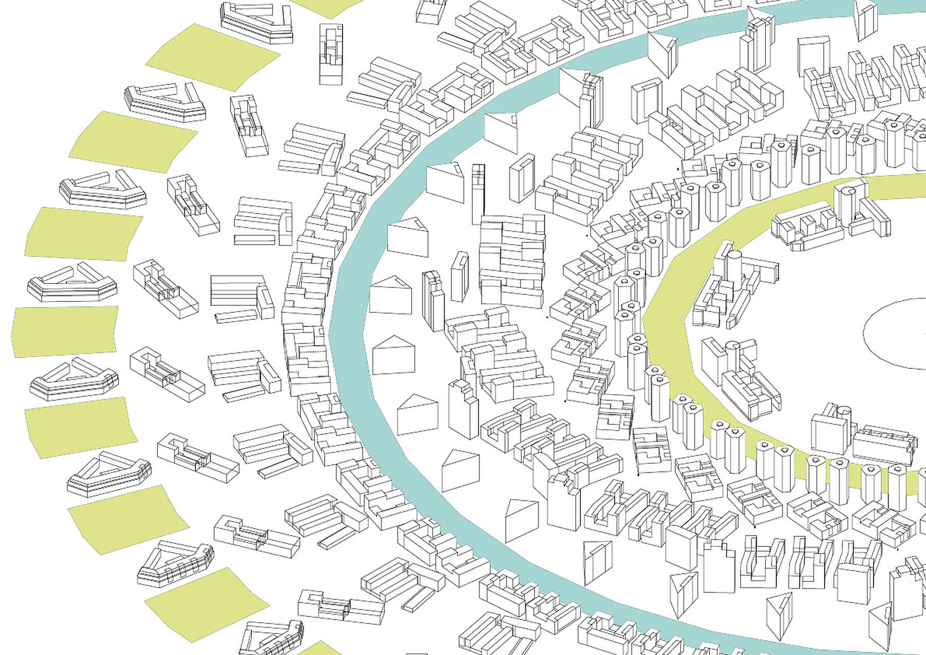
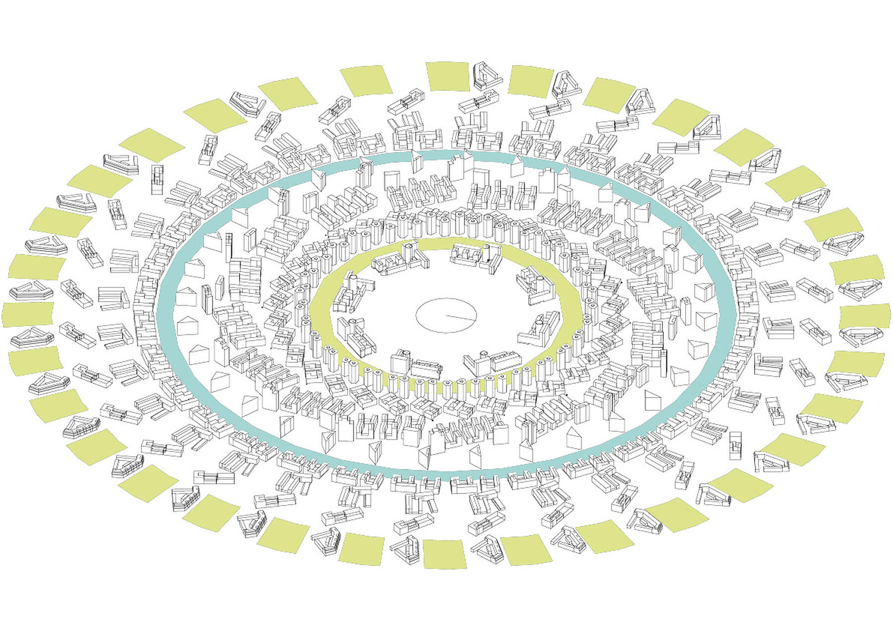
Density defined urbanism: Typologies arranged by density
The first study shows an abstracted slice of collaged typologies. These are arranged in order of density from high to low. Each typology is orientated on its ‘real life’ axis.
Significant urban landmarks such as parks, watercourses and infrastructure have also been shown in relation to their real life positioning and scale.
Where possible, each typology has been arranged to have a separation distance between the adjacent building true to the real life context of one of the typologies.
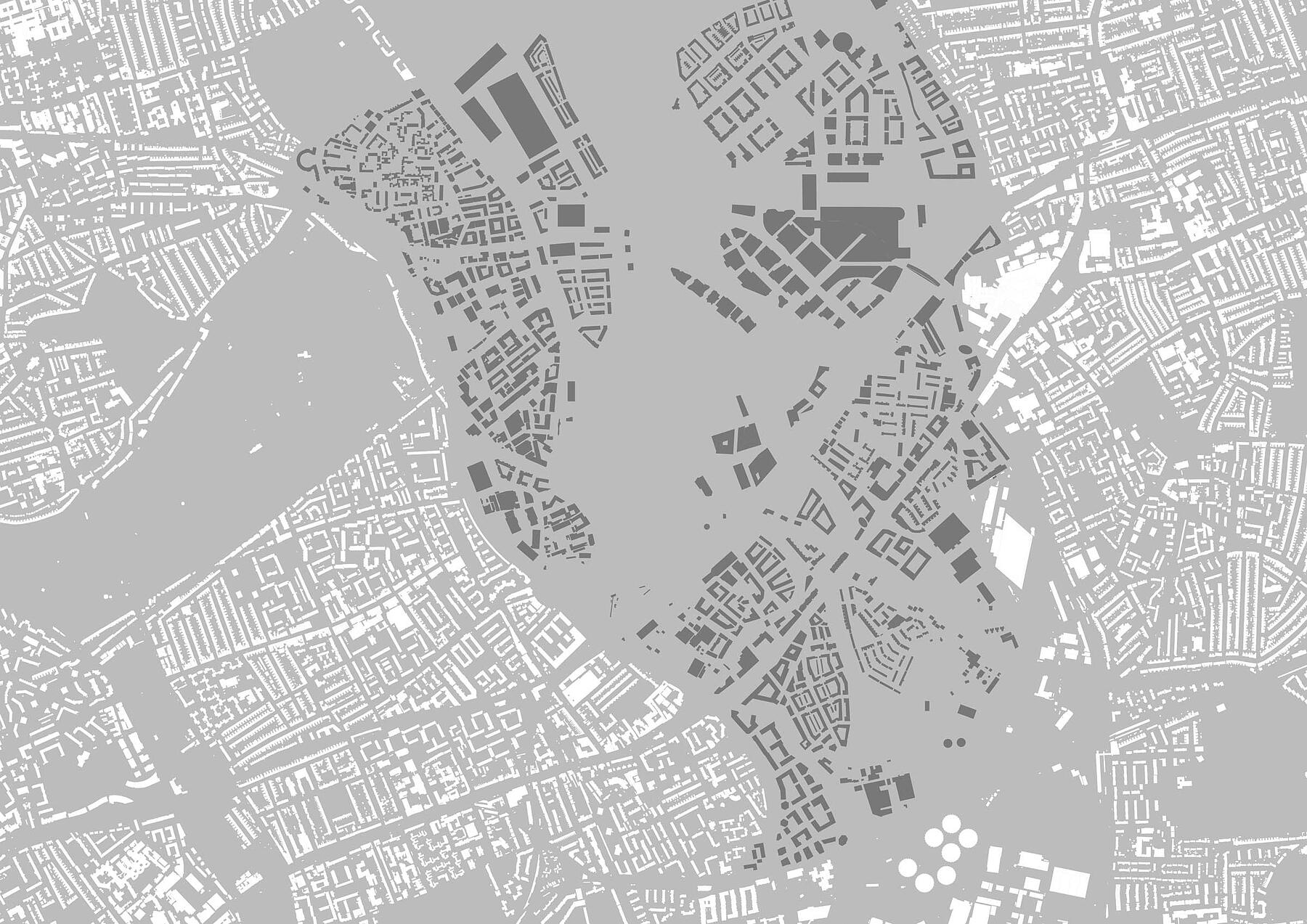
City ‘Pizza Slice’ North-South Axis
Typologies are arranged on a north south axis, in their orientation which creates the smallest number of compromised units. Where significant adjacent landforms are found by typologies, these have been modelled with their true depths e.g. the dock at Great Eastern Quays, and the Park to the front of the front of the Hoxton Press Towers. Streets and separation distances between buildings have also, as far as possible, been modelled to reflect their true existing condition.